I see that the locations reported by the API (https://maps.sensor.community/data/v2/data.dust.min.json) are truncated, giving not an exact location of each sensor. For example, sensor ID 64865 in the dashboard is set to the location (42.00217765684, 21.40919923782), while the API reports (42.002, 21.41). This moves the location of the sensor on a map 100-200 meters in a given direction.
This wasn’t the case before, so it seems like a recent change to the API. Anyone aware of this?
I can guess it’s made to save space in the huge file, but it would be good to have the option to go back to full GPS coordinates for devs who need it.
It seems that some sensors still have the whole coordinates.
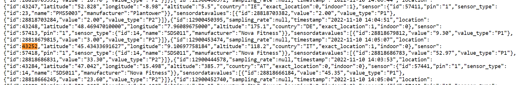
For privacy reasons there is a “exact position” checkbox in devices.sensor.community.
Is it checked or unchecked for your very sensor? @ricki-z ?
Ctrl + F in the json. Are you familiar with the json format for data ?
Or you can try to use a json formatter to get a better overview.
This list is actually what is used by the map to show the hexagons.